Cool story on CNN about some new species being discovered — including an amazing end to the first paragraph where they describe “a frog that makes love in the rain” — on the northern tip of Queensland, Australia. The species were located in a remote mountain range on Cape York Peninsula; scientists had previously surveyed the base of the range, but had mostly not gone into the rainforest on top.
This all got me thinking: purportedly, the surface area of the Earth is 196.9 million square miles. Is it possible that all of this is mapped? No, right? It cannot be. (I’m probably using surface area as a metric incorrectly here, but I wasn’t ever very good at geometry or other spatial math, so cut me some slack on that front.)
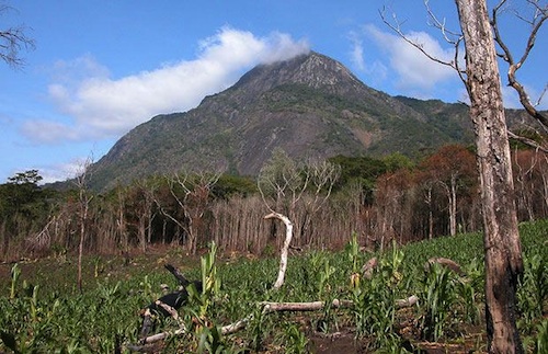
In 2008, Google Earth led some scientists to discover Mount Mabu in Mozambique, now sometimes referred to as “The Google Forest.” In 2007, discoveries of sub-lakes in Antarctica were considered new geographic frontiers; Lake Vostok may be the most famous of those. We also need to remember that, by some estimates, 90 percent of the oceans remain unexplored — and since the ocean is 70 percent of the world, theoretically we know about as much about our world (percentage-wise) as they did in the 1500s. That seems odd when you consider the rapid ramp-up of technology.
This list sheds some additional light on unmapped areas. Notably, Gangkhar Puensum in Bhutan, which may be the highest unclimbed mountain in the world.
Google Maps essentially revolutionized a lot of this discussion; in addition to their discovery in Mozambique referenced above, they worked with an Afghan man in 2011 to map areas of that part of the world. They even have a good portion of North Korea; the flip side of the Google equation is that not being mapped can reinforce social inequality, as outlined in Atlantic Cities.
This message board runs down a few more options, and conventional logic would indicate that a large portion of New Guinea is unexplored. In fact, just this summer a group of kayakers attacked the Chimbu River, which to that point had been unpaddled (note the length of its Wiki entry).
Much of the Amazon Basin is also unexplored, as is the Congo River Basin.
Project Confluence (or the Degree Confluence Project) is attempting to take pictures at every latitude/longitude combination in the world; they call it an “organized sampling of the world.” So far they have 104,624 photographs in 186 countries. Here’s one of the most recent shots, from Germany.
